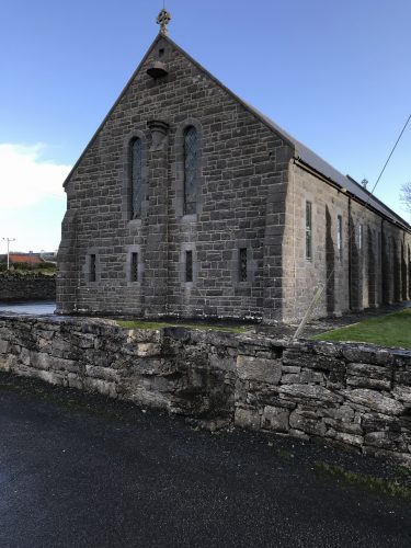
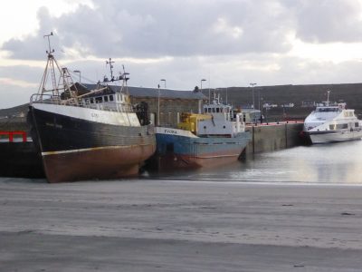
Or Inish Mór has an area of 31 km2 (12 sq mi) & with a population of about 840 it has the largest populate of the 3 islands that make up the Aran Islands. One can get the shuttle for Galway center (my hostess Orla drove me there so I wouldn’t miss it) and then a 1 1/4 hour ride to the ferry which takes about an hour to land on the island. Rather than take a bus tour to see some old castle ruins and cliffs whilst being regaled by some guy dropping all his “H”s (pronounced in Ireland sort like ‘hech’) telling the same tale he tells every day, I opted for a solo walk. I made a good choice. I started in the wee town of Kilronan, Kil meaning church, where the ferry debarks.
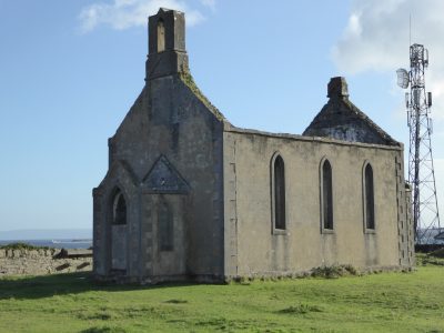
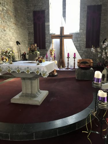
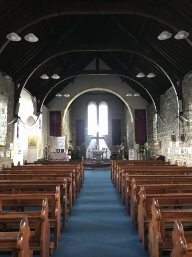
When I entered Holy Mary of the Immaculate Conception I was greeted by the smell of lilies as there was a large bouquet just inside the door. The church was empty and all decked out for the holiday
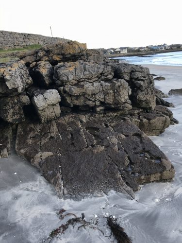
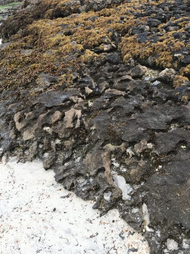
From here I headed for the large beach area to sit on the unusual rocks and enjoy the some warm sunshine.
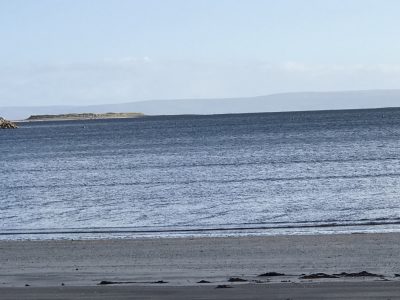
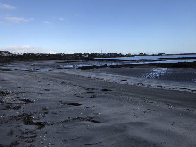
The view from my rock perch.
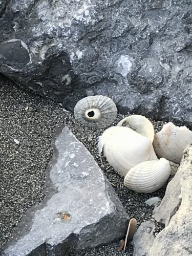
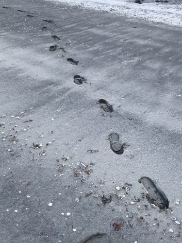
And the beach was littered with shells
s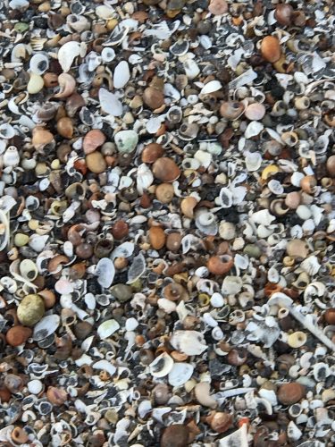
And as you can see from the depth of my footprints, the sand was very soft
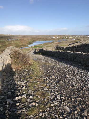
From the beach I spotted a old road that soon turned into large gravel and grass so off I went.
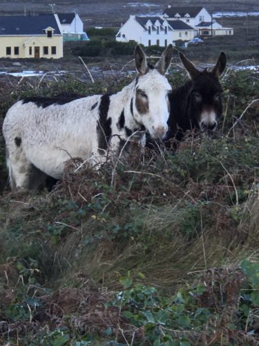
Passing the two Jack & Don along the way. Three hours later they were in the exact same place. Exact.
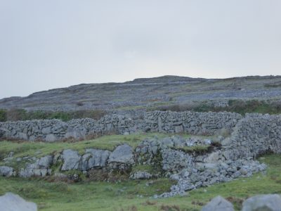
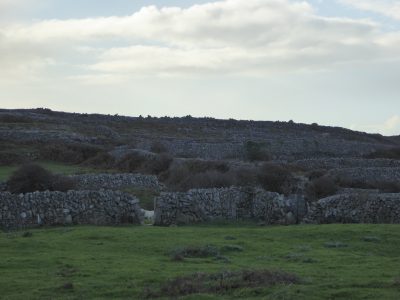
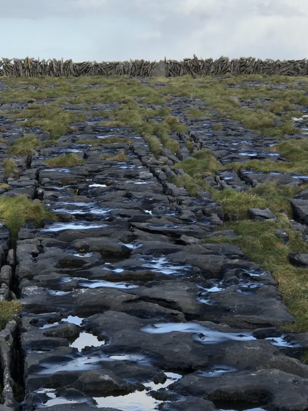
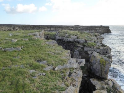
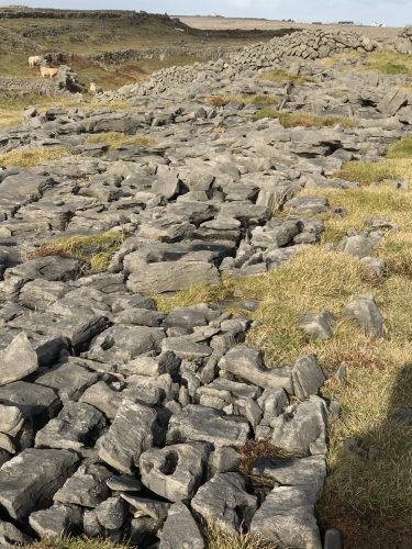
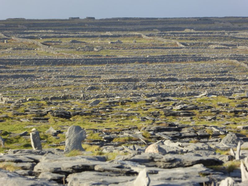
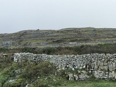
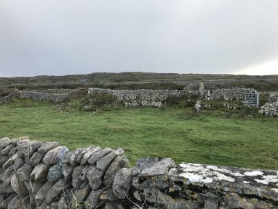
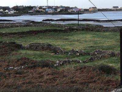
There are reported to be over 3000 miles of stone walls on the island. The rocks wee stack with the due lpurpose of making fences and learning field for maybe some crops but also for grazing land.
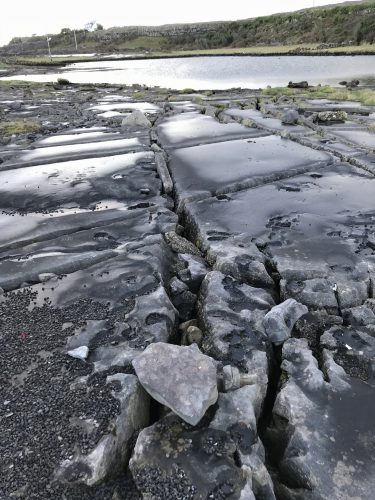
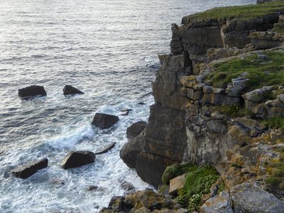
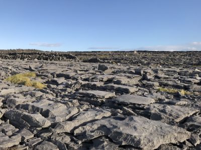
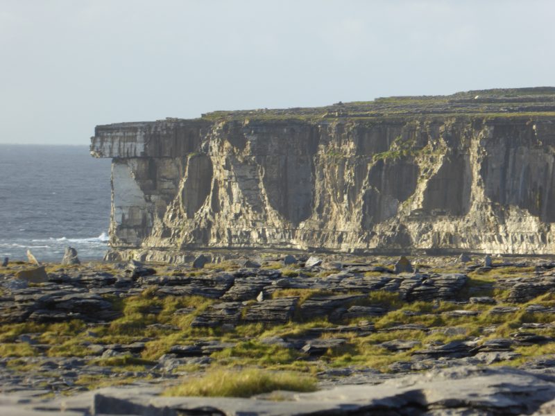
I realized as I climbed the hills that the end had to be cliffs and I was right. Along the way I found the rock formations different from any I had seen before.
And thanks to Wikipedia:
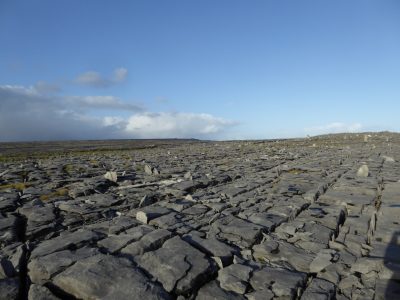
The islands’ geology is mainly karst limestone, related to the Burren in County Clare (to the east), not the granites of Connemara to the north. This is most obvious in the construction of the walls around the fields.
The limestones date from the Viséan age of the Lower Carboniferous), formed as sediments in a tropical sea approximately 350 million years ago, and compressed into horizontal strata with fossil corals, crinoids, sea urchins, and ammonites. Glaciation following the Namurian facilitated greater denudation. The result is that the Aran Islands are one of the finest examples of a Glacio-Karst landscape in the world. The effects of the last glacial period (the Midlandian) are most in evidence, with the islands overrun by ice during this glaciation. The impact of earlier karstification (solutional erosion) has been eliminated by the last glacial period. Any karstification now seen dates from approximately 11,000 years ago and the island karst is thus recent.
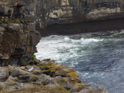
Solutional processes have widened and deepened the grykes of the limestone pavement. Pre-existing lines of weakness in the rock (vertical joints) contribute to the formation of extensive fissures separated by clints (flat pavement like slabs). The rock karstification facilitates the formation of subterranean drainage.
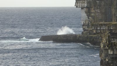
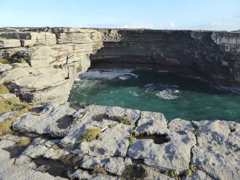
Huge boulders up to 25 metres (80 ft) above the sea at parts of the west facing cliffs are in some cases an extreme form of storm beach, cast there by giant waves that occur on average once per century, though more are glacial erratics.[2]
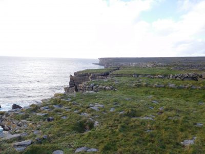
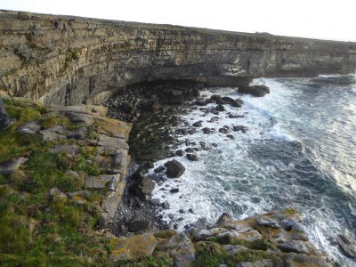
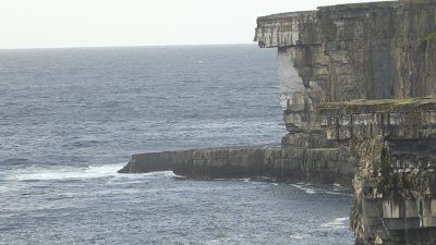
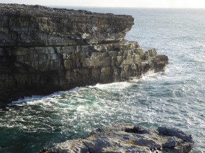
This cliff edge give a very good reminder of why you should not get too close to the edge. Although were it to collapse whilst anyone was on it they would save the family burial expenses!
Almost makes the trip to the Cliffs of Moher redundant
Getting here was tough. Getting back will be harder
For where’ve I looked there seemed to be new walls to clamber over
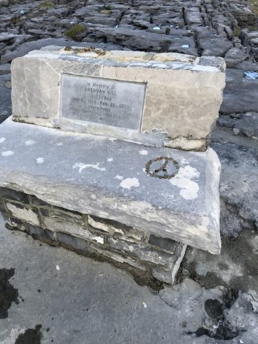
People had tossed lots of copper coins around this memorial seat, I’m guessing in prayer. I hope my collecting the mind arranging them in a Peace Symbol was not wrong by local standards.
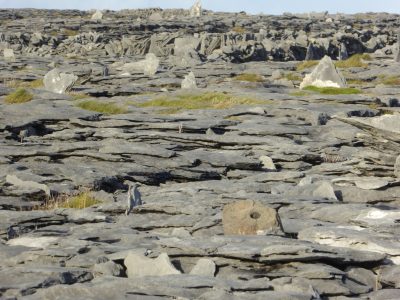
I’m guessing these small, flat upright stones were placed by people not the work of glaciers
And the way the light hit the cliffs it makes it look like the end has a sharp needle running vertically but it solid rock, just the sunlight
Walls, Walls, Walls
Low tide
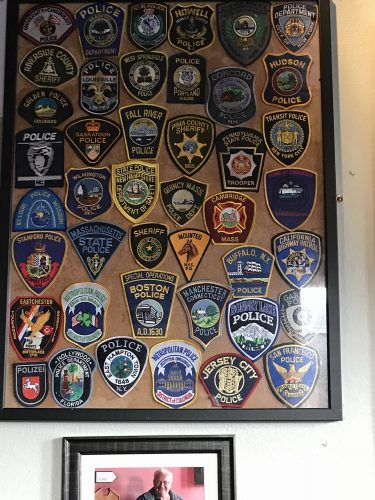
The Bar, formerly The American Bar was one of the last places folks emigrating to America could have a final pint. After 9-11 fire and police officers would come to Ireland to march in parades and often left their badges as calling cards. The Br has 3x this still to be mounted, but since I was born in Boston, my cousin is a MA State Trooper and my family is from Manchester CT, 3 badges leaped out at me
8.06 miles
{ 0 comments… add one now }